
Overview
Background
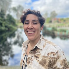
Laura Natali Sotomayor is a Research Platform Fellow (Geospatial Data Scientist) with the UQ Drone Collaborative Research Platform, based within the W.H. Bryan Mining Geology Research Centre at the Sustainable Minerals Institute. She develops tools and workflows to process, analyse and interpret drone-acquired multi-sensor imagery and lidar data, supporting research and industry applications.
She completed her PhD in Geomatic Engineering at the University of Tasmania, where her research developed deep learning workflows for multi-sensor Unoccupied Aerial Systems (UAS) monitoring of vegetation in semi-arid rangelands, combining remote sensing techniques with automated image analysis to translate high-resolution imagery into spatially explicit information on vegetation cover, structure, and function.
Availability
- Miss Laura N. Sotomayor is:
- Available for supervision
Fields of research
Qualifications
- Masters (Research) of Computer Science (Information Technology), University of Tasmania
Works
Search Professor Laura N. Sotomayor’s works on UQ eSpace
2026
Conference Publication
Mapping vegetation functional states across climate extremes: spectral deep learning from drylands to Antarctic cryptogam ecosystems
Sotomayor, Laura N., Lucieer, Arko, Turner, Darren, Haynes, Ryan, Cimoli, Emiliano, Youssef, Mathew, Galvez-Serna, Julian, Fedrigo, Melissa, Kattenborn, Teja and Barthélemy, Johan (2026). Mapping vegetation functional states across climate extremes: spectral deep learning from drylands to Antarctic cryptogam ecosystems. 12th SCAR Open Science Conference, Oslo, Norway, 10 - 14 August 2026. doi: 10.5281/zenodo.23518885
2026
Journal Article
A CNN with spectral-channel adaptation for interpretable and edge-ready fractional vegetation cover mapping using UAS multispectral and imaging spectroscopy
Sotomayor, Laura N., Lucieer, Arko, Turner, Darren, Haynes, Ryan, Barthelemy, Johan and Kattenborn, Teja (2026). A CNN with spectral-channel adaptation for interpretable and edge-ready fractional vegetation cover mapping using UAS multispectral and imaging spectroscopy. doi: 10.31223/X5PV20
2026
Journal Article
From 2D labels to 3D structure: Scalable label transfer and benchmarking of 3D vegetation models in rangeland ecosystems
Sotomayor, Laura N., Lucieer, Arko, Turner, Darren, Barthelemy, Johan and Kattenborn, Teja (2026). From 2D labels to 3D structure: Scalable label transfer and benchmarking of 3D vegetation models in rangeland ecosystems. doi: 10.31223/X5948M
2025
Journal Article
deadtrees.earth - An open-access and interactive database for centimeter-scale aerial imagery to uncover global tree mortality dynamics
Mosig, Clemens, Vajna-Jehle, Janusch, Mahecha, Miguel D., Cheng, Yan, Hartmann, Henrik, Montero, David, Junttila, Samuli, Horion, Stephanie, Schwenke, Mirela Beloiu, Koontz, Michael J., Maulud, Khairul Nizam Abdul, Adu-Bredu, Stephen, Al-Halbouni, Djamil, Ali, Muhammad, Allen, Matthew, Altman, Jan, Amoros, Lot, Angiolini, Claudia, Astrup, Rasmus, Awada, Hassan, Barrasso, Caterina, Bartholomeus, Harm, Beck, Pieter S. A., Bozzini, Aurora, Braun-Wimmer, Joshua, Brede, Benjamin, Breunig, Fabio Marcelo, Brugnaro, Stefano, Buras, Allan ... Revuelto, Jesus (2025). deadtrees.earth - An open-access and interactive database for centimeter-scale aerial imagery to uncover global tree mortality dynamics. Remote Sensing of Environment, 332. doi: 10.1016/j.rse.2025.115027
2025
Journal Article
Mapping fractional vegetation cover in UAS RGB and multispectral imagery in semi-arid Australian ecosystems using CNN-based semantic segmentation
Sotomayor, Laura N., Lucieer, Arko, Turner, Darren, Lewis, Megan and Kattenborn, Teja (2025). Mapping fractional vegetation cover in UAS RGB and multispectral imagery in semi-arid Australian ecosystems using CNN-based semantic segmentation. Landscape Ecology, 40 (8) 169, 1-34. doi: 10.1007/s10980-025-02193-y
2025
Conference Publication
Sensor-agnostic 3D structure mapping pipeline: from UAS-derived 2D orthophotos and LiDAR point clouds to volumetric training data for 3D U-Net modelling
Sotomayor, Laura N., Lucieer, Arko, Turner, Darren, Lewis, Megan, Shaun, Levick and Kattenborn, Teja (2025). Sensor-agnostic 3D structure mapping pipeline: from UAS-derived 2D orthophotos and LiDAR point clouds to volumetric training data for 3D U-Net modelling. IEEE International Geoscience and Remote Sensing Symposium (IGARSS 2025), Brisbane, Australia, 3-8 August 2025. doi: 10.5281/zenodo.23946673
2025
Conference Publication
Deep learning for identification of 3D plant growth forms in Fractional Vegetation Cover
Sotomayor, Laura N., Turner, Darren, Megan, Lewis, Levick, Shaun and Kattenborn, Teja (2025). Deep learning for identification of 3D plant growth forms in Fractional Vegetation Cover. European Geosciences Union General Assembly 2025 (EGU25), Vienna, Austria, 27 April-2 May 2025. doi: 10.5194/egusphere-egu25-3984
2024
Conference Publication
Investigating Deep Learning Techniques to Estimate Fractional Vegetation Cover in the Australian Semi-arid Ecosystems combining Drone-based RGB imagery, multispectral Imagery and LiDAR data
Sotomayor, Laura N., Kattenborn, Teja, Darren, Turner, Lewis, Megan and Lucieer, Arko (2024). Investigating Deep Learning Techniques to Estimate Fractional Vegetation Cover in the Australian Semi-arid Ecosystems combining Drone-based RGB imagery, multispectral Imagery and LiDAR data. European Geosciences Union General Assembly 2024 (EGU24), Vienna, Austria, 14-19 April 2024. doi: 10.5194/egusphere-egu24-5766
2023
Journal Article
Supervised machine learning for predicting and interpreting dynamic drivers of plantation forest productivity in northern Tasmania, Australia
Sotomayor, Laura N., Cracknell, Matthew J. and Musk, Robert (2023). Supervised machine learning for predicting and interpreting dynamic drivers of plantation forest productivity in northern Tasmania, Australia. Computers and Electronics in Agriculture, 209 107804. doi: 10.1016/j.compag.2023.107804
Supervision
Availability
- Miss Laura N. Sotomayor is:
- Available for supervision
Looking for a supervisor? Read our advice on how to choose a supervisor.
Media
Enquiries
For media enquiries about Miss Laura N. Sotomayor's areas of expertise, story ideas and help finding experts, contact our Media team: