Affiliate of Centre for Environmental Responsibility in Mining
Centre for Environmental Responsibility in Mining
Faculty of Engineering, Architecture and Information Technology
Research Fellow/Senior Research officer
Sustainable Minerals Institute
Faculty of Engineering, Architecture and Information Technology
Availability:
Available for supervision
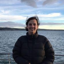
Dr Nevenka Bulovic is a water resource engineer and her current research focus is on improving the climate resilience of the mining sector in the face of climate change. This work applies state-of-the-art climate models to assess risks to water availability, mine site rehabilitation and pollution risks. Nevenka's other research passion is in using remotely sensed data and novel approaches for improving knowledge on hydroclimate in data sparse regions such as Australia and the Andes.
Affiliate of Centre for Environmental Responsibility in Mining
Centre for Environmental Responsibility in Mining
Faculty of Engineering, Architecture and Information Technology
Senior Research Fellow
Sustainable Minerals Institute
Faculty of Engineering, Architecture and Information Technology
Availability:
Available for supervision
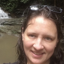
Lorna Hernandez Santin is a restoration ecologist whose research focuses on understanding, monitoring, and improving ecosystem recovery and biodiversity outcomes following disturbance. Her work integrates restoration ecology, fauna ecology, conservation biology, environmental monitoring, remote sensing, and spatial analysis to support evidence-based restoration and nature-positive outcomes.
As Acting Group Leader of the Ecosystem & Biodiversity Group within the Centre for Environmental Responsibility in Mining, Lorna contributes to research that assesses mining impacts on flora and fauna, develops approaches to restore ecosystem services, supports recolonisation by native species, and improves the long-term sustainability of disturbed landscapes. See the group’s website for more information: [smi.uq.edu.au].
Lorna collaborates with industry, government, and research partners to improve how restoration success is defined, measured, and achieved. Her research supports the application of the mitigation hierarchy and adaptive management, helping organisations avoid and minimise impacts, implement effective restoration strategies, and evaluate ecological recovery using robust monitoring approaches. This work aims to improve biodiversity outcomes throughout the mine life cycle, from project planning and impact mitigation to rehabilitation, mine closure, and post-closure recovery. Her research also explores the use of emerging technologies, including drone- and satellite-based remote sensing, hyperspectral imaging, and automated species detection, to improve environmental monitoring and restoration assessment.
Current research interests include:
Mine rehabilitation and ecological restoration
Fauna ecology and biodiversity conservation
Restoration assessment and ecosystem recovery trajectories
Restoration frameworks, standards, targets, and completion criteria
Ecological indicators and monitoring frameworks
Environmental monitoring using field-based methods and remote sensing technologies, including imagery collected from drones, aircraft, and satellites using RGB, multispectral, and hyperspectral sensors
Species detection, habitat assessment, and spatial modelling using remote sensing approaches
Landscape ecology and spatial analysis
Evidence-based approaches to mine closure and environmental management
Her broader research experience includes wildlife ecology, conservation biology, habitat suitability modelling, species distributions, movement ecology, and biodiversity monitoring across Australia and the Americas.
Affiliate of Dow Centre for Sustainable Engineering Innovation
Dow Centre for Sustainable Engineering Innovation
Faculty of Engineering, Architecture and Information Technology
Deputy Head of School of Civil Engineering
School of Civil Engineering
Faculty of Engineering, Architecture and Information Technology
Professor & Chair of Transport Eng
School of Civil Engineering
Faculty of Engineering, Architecture and Information Technology
Availability:
Available for supervision
Media expert
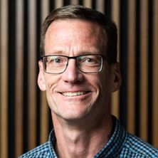
Dr. Mark Hickman is the TAP Chair and Professor of Transport Engineering within the School of Civil Engineering at the University of Queensland. Prof. Hickman has taught courses and performed research in public transit planning and operations, travel demand modelling, and traffic engineering. His areas of research interest and expertise include public transit planning and operations, urban transportation planning and modelling, and the development of sustainable transport innovations and policies.
I am specialised in remote sensing, Earth observation (EO), and geospatial data science. My current research centres on modelling canopy height by integrating GEDI LiDAR and Sentinel-2 satellite data. This work leverages high-performance computing (HPC), cloud platforms, and machine learning (ML) to produce scalable, reproducible workflows for environmental monitoring and decision support.
My current focus includes:
EO-driven canopy height estimation for forest structure and biomass monitoring
Scalable HPC/cloud workflows for processing LiDAR and satellite data
AI/ML applications in EO for ecosystem modelling and climate resilience
Supporting policy and land planning with EO-derived environmental indicators
Previously, I led research on satellite-based grassland curing to improve fire monitoring, addressing inter-satellite variability and product accuracy for use by fire managers. I also contributed to government-led programs focusing on environmental water planning and provide the framework for coordinating the development of flood works.
I collaborate with academic, government, and industry stakeholders nationally and internationally to ensure EO science translates into tools and insights that support environmental monitoring.
Faculty of Engineering, Architecture and Information Technology
Availability:
Available for supervision
Media expert
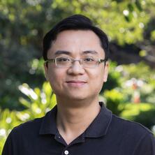
Dr Nguyen is a Lecturer in Robotics at the School of Mechanical and Mining Engineering, The University of Queensland. His research focuses on advancing autonomous robot capabilities in complex, large-scale environments through 1) principled and scalable fusion of complementary sensing modalities with distilled prior knowledge from learning processes for localisation & mapping, and 2) cooperative strategies for multi-robot systems. These research directions address challenging scenarios such as inspection, exploration, and manipulation, where robust localisation & mapping form a solid foundation upon which collaborative schemes can unlock new levels of efficiency and scalability.
Dr Nguyen was previously a Research Assistant Professor at the Centre for Advanced Robotics Technology Innovation (CARTIN), Nanyang Technological University (NTU), following the Wallenberg–NTU Presidential Postdoctoral Fellowship, where he led collaborative research efforts between NTU and KTH Royal Institute of Technology. He received his PhD from the School of EEE, NTU, with the best thesis (Doctoral Innovation Award) in 2020. He graduated with a Bachelor of Engineering (Honours) from Vietnam National University – Ho Chi Minh City University of Technology in 2014. He is an active member of IEEE Robotics and Automation Society (RAS), and is currently an Associate Editor of IEEE Robotics and Automation Letters (RA-L) in the area of Localisation & Mapping.
Affiliate of Centre for Biodiversity and Conservation Science
Centre for Biodiversity and Conservation Science
Faculty of Science
Associate Professor
School of the Environment
Faculty of Science
Availability:
Available for supervision
Media expert
Research interest: Monitoring ecosystem health of coral reefs and seagrass habitats, integrating field and remote sensing image datasets, and the developing applied cost-effective mapping and monitoring approaches. Developed approaches have been adopted as standard practice globally, making a difference in conservation of these valuable habitats. The long term monitoring studies at Heron and Moreton Bay formed the basis for the development of mapping and monitoring over time and space at local to global scale. See here major research impact
Major projects:
Long term monitoring of benthic composition at Heron Reef (2002-ongoing).
Long term monitoring of seagrass composition and abundance in Moreton bay Marine Park (2000-ongoing).
Smart Sat CRC Hyperspectral Remote Sensing of Seagrass and Coral Reefs 2023-2027.
Developement of Underwater Field Spectrometry and Benthic Photo Collection and Analysis
3D GBR Habitat Mapping Project 2015 - ongoing:
Global habitat mapping project 2019-2023 Allen Coral Atlas .
Current position: Associate Professior in Marine Remote Sensing leading the Marine Ecosystem Monitoring Lab. . Academic Director Heron Island Research Station and affiliated researchers with Centre for Marine Science and Centre for Biodiversity and Conservation Science
Capacity Building and Citizen Science: Capacity: under/post graduate courses; Msc/PhD supervision, workshops/courses; Remote Sensing Educational Toolkit, and online courses (e.g. TNC).Strong supporter of citizen science based projects, as trainer, organiser and advisor for Reef Check Australia, CoralWatch, Great Reef Census and UniDive.
Broad remote sensing skills across terrestrial and aquatic environments. Working to democratise spatial data access and use. Happiest when producing and delivering automated, operational and validated national and global scale products that can be used by scientists, policy and the public.
Angelica is a senior spatial scientist with a strong background in remote sensing and environmental analysis. Her work bridges science and practice, applying spatial technologies to improve land and resource management. She has contributed to research across a wide range of applications — from crop and vegetation monitoring to assessing land use change driven by different sectors.
Her research interests include the evaluation and adoption of remote sensing technologies for crop and vegetation monitoring, tracking native vegetation clearing and regrowth, analysing environmental and production factors that influence crop performance, and developing spatial datasets for yield forecasting, crop phenotyping, and long-term landscape monitoring.
Queensland Alliance for Agriculture and Food Innovation
Availability:
Available for supervision
Dr Yan Zhao is an agricultural remote sensing and digital agriculture scientist specialising in the integration of Earth observation, artificial intelligence, crop modelling and climate information for crop monitoring and decision support. His research spans satellite, UAV and proximal sensing to quantify crop type, phenology, soil moisture, crop stress and yield across field to regional scales. He develops scalable spatial-data and machine-learning approaches to translate complex sensing and environmental data into practical agricultural information, working closely with growers, agribusiness, government and international research partners. His current research increasingly explores multi-source hyperspectral sensing and analytics for detecting crop stress and assessing crop productivity and grain quality.